Trail guide/START HERE / NIGHT RIDE 00

START HERE / NIGHT RIDE 00

Start with the ground. Then look up.

Choose the part of Colorado you actually want to reach first, then decide how dark you want the sky. The Night Ride will narrow the guide from there.

LAND + SKY / PREAMBLE

Respect the land.
Share the sky.

ColoradoStargazingTrail.com pays respect to the Indigenous peoples and sovereign Tribal Nations whose homelands include what is now Colorado, including Ute, Cheyenne, Arapaho and Puebloan peoples. Those relationships with land and sovereignty are living and continuing.

Now look up. The borders on the ground sit beneath one continuous sky. People everywhere have used that sky for navigation, seasons, science, ceremony, memory and story. The constellations change with culture; the stars keep crossing every line on the map.

How this guide approaches land + sky
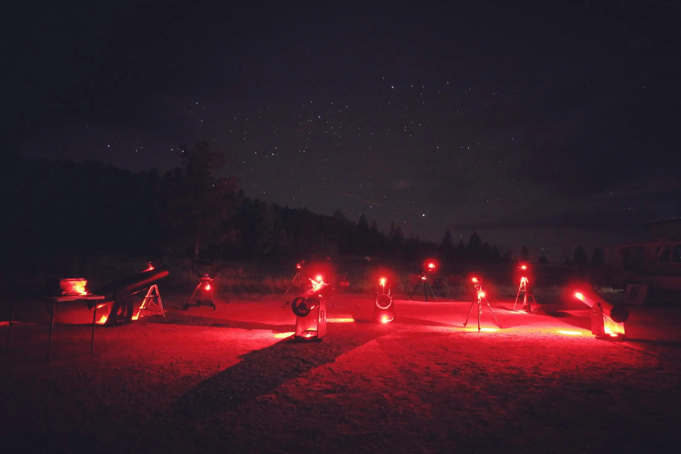
A line of telescopes glowing red beneath a dark sky
FIELD ARCHIVE / 03RED LIGHT PRESERVES NIGHT VISION

FIRST BRANCH / GEOGRAPHY

Where do you want to ride tonight?

Choose the road first. These regions overlap on purpose. Denver is the shared western/eastern hinge for several of them, while places like Alamosa, Steamboat Springs, Gunnison and Durango become the more useful local hubs farther out.

STATEWIDE MAP / GUIDE GEOGRAPHY

Colorado, all at once.

Every mapped guide stop in Colorado sits on the same USGS/Census geography. The colored washes are curated guide travel zones; dashed lines show the five editorial loop sequences. Featured guided programs are marked separately from general guide stops.

MAP KEY ↗

Swipe map to explore

Central Mountains & High CountryEastern & Southeast PlainsDenver, Front Range & Pikes PeakNorthwest Canyon CountrySan Luis Valley & Sangre de CristoSouthwest & Four CornersWestern Slope & Gunnison Country
Denver
Colorado Springs
Fort Collins
Boulder
Pueblo
Grand Junction
Durango
Steamboat Springs
Gunnison
Montrose
Alamosa
Cortez
Glenwood Springs
Aspen
Breckenridge
Salida
Trinidad
Lamar
Craig
AstroTours.orgBoulder Valley RanchAspen Mountain SundeckAspen Stargazing / The Gant listingBlack Canyon of the Gunnison National ParkBoulderBreckenridgeBrowns Canyon National MonumentC Lazy U RanchCampVChamberlin ObservatoryChimney Rock National MonumentColorado National MonumentColorado Trail / Willow Creek Dark-Sky PointComanche National GrasslandCrawford State ParkCrestoneCuchara / Bear & Blue LakesCurecanti National Recreation AreaDinosaur National MonumentDurango Welcome Center Dark Sky KitsEleven Mile State ParkElkhead Reservoir State ParkEstes Park Memorial ObservatoryFlorissant Fossil Beds National MonumentGolden Gate Canyon State ParkGrand Mesa ObservatoryGreat Sand Dunes National Park and PreserveGunnison Gorge National Conservation AreaGunnison Valley ObservatoryHighline Lake State ParkHovenweep National MonumentJackson Lake State ParkJohn Martin Reservoir State ParkKim / Southeast Colorado dark countryLake Pueblo State ParkLittle Thompson ObservatoryLoveland PassMadison-Macdonald ObservatoryMarshall PassMesa Verde National ParkMueller State ParkNorwoodNucla & NaturitaOld SnowmassOuray KOA Holiday StargazingPaonia State ParkPaoniaPawnee National GrasslandPine River Library Dark Sky KitsRidgway State ParkRidgwayRifle Gap State ParkRocky Mountain National ParkLake Fork Earth & Sky Center / SlumgullionSmokey Jack ObservatorySouthern Colorado Astronomical ParkStarry Meadows / Rocky Mountain Star StareState Forest State ParkStaunton State ParkSteamboat Lake State ParkThe Nest at Black HawkTop of the PinesTrinidad Lake State ParkUFO WatchtowerValley View Hot SpringsWestcliffe & Silver Cliff
USGS TOPOCENSUS TIGER / MAJOR ROADS65 GUIDE PLACES IN FRAME

Official trail placeReference center from the verified place-map record.

Guide additionIndependent stop or resource outside the official 21.

Featured guided programPublished meeting location. Booking/access rules still apply.

Guide loop corridorStop sequence, not turn-by-turn routing.

Guide region travel zoneCurated geographic extent; intentionally overlapping and not an administrative boundary.

MAP DATAUSGS The National Map supplies terrain, names and base transportation. Census TIGERweb reinforces primary/secondary road geometry. Colored guide regions are curated travel-zone overlays; loop lines connect the route’s mapped stop centers. Featured program pins use the operator’s published meeting-location coordinates.
REGION 01 / DENVER → PASSES → RESORT TOWNS

Central Mountains & High Country

Denver is the natural eastern gateway, then the road splits into Summit County, the Arkansas Valley and higher mountain country. State Forest State Park forms a deliberate northern overlap with the Front Range and Northwest regions.

GATEWAYDenver / I-70 + US-285
REGIONAL HUBBreckenridge / Buena Vista
DARKNESSDark with town glow
REGION 02 / DENVER → OPEN HORIZON

Eastern & Southeast Plains

Denver is the western gateway and overlap for this region, where the city gives way to prairie. From there the road splits northeast toward Pawnee and Jackson Lake or southeast toward Pueblo, Lamar, Kim and Comanche.

GATEWAYDenver / Front Range
REGIONAL HUBFort Morgan northeast / Pueblo southeast
DARKNESSDark → exceptionally dark
REGION 03 / FORT COLLINS → DENVER → TRINIDAD

Denver, Front Range & Pikes Peak

The long Front Range spine: Fort Collins, Boulder and Denver in the north; Colorado Springs and Pueblo through the middle; Trinidad at the southern edge, with foothill and observatory stops branching off the I-25 corridor.

GATEWAYFort Collins / Denver / Trinidad
REGIONAL HUBDenver, with Colorado Springs for the south end
DARKNESSModerate → dark
REGION 04 / STEAMBOAT → CANYON COUNTRY

Northwest Canyon Country

Steamboat Springs is the main eastern gateway to this region, with State Forest State Park intentionally overlapping from North Park. From there the road runs west and northwest into reservoirs, high basins, Craig and Dinosaur country without pulling the map back toward the Front Range cities.

GATEWAYSteamboat Springs
REGIONAL HUBSteamboat Springs
DARKNESSDark → very dark
REGION 05 / COLORADO SPRINGS / PUEBLO → ALAMOSA

San Luis Valley & Sangre de Cristo

Colorado Springs and Pueblo form the northern approach, with Browns Canyon as an intentional overlap into the Arkansas Valley. Alamosa becomes the real hub once the road crosses into the valley and the sky opens around the dunes, hot springs and Sangres.

GATEWAYColorado Springs / Pueblo
REGIONAL HUBAlamosa
DARKNESSVery dark
REGION 06 / DURANGO HUB → FOUR CORNERS

Southwest & Four Corners

This region does not need to bend back toward Denver. Durango is the natural launch, with Cortez and Pagosa Springs taking over for the western and eastern sides of the Four Corners road.

GATEWAYDurango
REGIONAL HUBDurango / Cortez
DARKNESSDark → very dark
REGION 07 / BRECKENRIDGE → CANYONS + MESAS

Western Slope & Gunnison Country

Breckenridge is the eastern edge of this region. From there the useful hubs move west to Gunnison, Montrose, Grand Junction and the Roaring Fork Valley, with the Lake City high country holding some of the darkest mountain sky in the guide.

GATEWAYBreckenridge
REGIONAL HUBGunnison / Montrose, with Grand Junction for the far west
DARKNESSDark → Bortle 1 high country

SECOND BRANCH / DARKNESS

How dark do you want the sky?

Pick the Bortle class that matches the night you want. Lower numbers mean darker skies. Choosing a level jumps you straight to the Colorado stops currently rated at that level.

Lower number means darker sky. These are quick planning estimates or field/source-supported ratings for the guide location, not a guarantee for an entire park or town. See every location by Bortle class ↗ · Read the Bortle scale ↗

COSMIC ROULETTE / RANDOM GUIDE SIGNAL

Can't decide? Let the stars guide you.

Click once and the guide will race through the places on the statewide map, lock onto one at random, then open that place page.

SIGNALAWAITING STAR SIGNAL